Höfn → Egilsstaðir
Today, 19 Oct · leaving 19:00 · Arrive around 23:26
- Wet in places, but no ice, snow or strong gusts expected.
- Distance
- 267 km
- Route 1
- Driving
- 4 h 2 min
- 4 h 26 min with breaks
- Highest point
- 355 m
- Fagridalur
- In the dark
- 4 h 26 min
- 1 pass

The road, stretch by stretch
Arrow keys move the map, plus and minus zoom, 0 shows the whole drive. Tap the road for the forecast and the report at that spot.
Vegagerðin's report right now, stretch by stretch.
- Clear261 km
- Not reported on6 km
- Webcams12
The road ahead
Height above the sea, the weather where you'll be when you're there, and the road surface it points to.
Webcams on the way
12 of Vegagerðin's cameras beside the road, in driving order — and when you pass each.
- Hafnarnesumferdin.is— Hafnarnes, livekm 3 · 10 m · around 19:02Clear right now
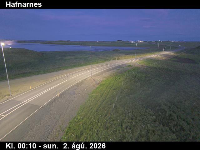
- Almannaskarð - suðurumferdin.is— Almannaskarð - suður, livekm 11 · 32 m · around 19:10Clear right now

- Almannaskarð - norðurumferdin.is— Almannaskarð - norður, livekm 12 · 64 m · around 19:12Clear right now

- Hvaldalsáumferdin.is— Hvaldalsá, livekm 51 · 10 m · around 19:49Clear right now

- Hvalnesskriðurumferdin.is— Hvalnesskriður, livekm 55 · 59 m · around 19:52Clear right now

- Gautavíkumferdin.is— Gautavík, livekm 133 · 17 m · around 21:07Clear right now

- Kambaskriðurumferdin.is— Kambaskriður, livekm 171 · 80 m · around 21:43Clear right now

- Víkurgerðiumferdin.is— Víkurgerði, livekm 196 · 24 m · around 22:09Clear right now
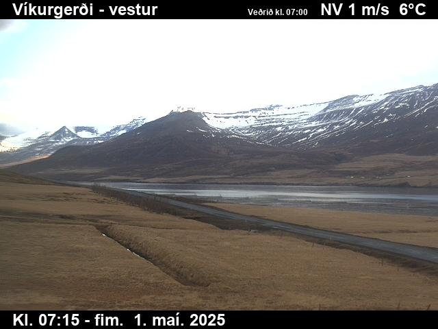
- Fáskrúðsfjarðargöng - suðurumferdin.is— Fáskrúðsfjarðargöng - suður, livekm 219 · 91 m · around 22:34Clear right now

- Fáskrúðsfjarðargöng - norðurumferdin.is— Fáskrúðsfjarðargöng - norður, livekm 225 · 33 m · around 22:41Clear right now

- Fagridalurumferdin.is— Fagridalur, livekm 250 · 347 m · around 23:07Clear right now
- km 257 · 208 m · around 23:15Clear right now

Webcams by Vegagerðin, the Icelandic Road and Coastal Administration (CC BY 4.0), refreshed every few minutes — the time is in the picture. See them all on umferdin.is.
Stop by stop
Times include short breaks. The surface is our estimate from the forecast.
- 19:00HöfnStart · 4 m5°1 ↑2 m/s0.9 mm/hWetDark
- 19:4848 minHvalnesNotorious gusts · 25 m6°2 ↑3 m/s1.5 mm/hWetDarkNow (18:50): 6° · road 7° · ↑4 m/s
- 20:391 h 39 minDjúpivogurOn the way · 4 m7°2 ↑5 m/s1.7 mm/hWetDark
- 21:362 h 36 minBreiðdalsvíkOn the way · 13 m6°6 ↑8 m/s1.4 mm/hWetDark
- 22:233 h 24 minFáskrúðsfjörðurOn the way · 30 m6°5 ↑8 m/s1.1 mm/hWetDark
- 22:493 h 50 minReyðarfjörðurOn the way · 25 m7°6 ↑13 m/s0.9 mm/hWetDark
- 23:084 h 9 minFagridalurMountain pass · 369 m5°8 ↑12 m/s0.4 mm/hWetDarkNow (18:50): 5° · road 5° · ↑9 m/s
- 23:264 h 26 minEgilsstaðirArrival · 29 m7°3 ↑5 m/sDryDark
The road surface here is our estimate from the forecast, not a report. Always check umferdin.is before you set off.
Tyres and the car
No ice or snow expected on this drive. Studs aren't allowed now unless conditions require them.
Studded tyres are allowed from 1 November to 14 April. Outside those dates the law allows them only when driving conditions require them.
On this road right now
Vegagerðin's latest report for each stretch, and the roadside stations.
Clear all the way, Vegagerðin reports.
| Station | Air | Road | Gusts |
|---|---|---|---|
| Hvalnes · 18:50 | 6° | 7° | 4 |
| Fagridalur · 18:50 | 5° | 5° | 9 |
Questions visitors ask
How long is the drive from Höfn to Egilsstaðir?
About 267 km on Route 1 — around 4 h 2 min of driving, longer with stops for fuel, food and photos.
What's the highest point on the road from Höfn to Egilsstaðir?
Fagridalur, about 355 m above the sea. The road crosses Fagridalur — the places where ice and snow come first. Hvalnes is known for violent gusts.
Is the road from Höfn to Egilsstaðir open today?
Yes — Vegagerðin reports the road clear all the way. Conditions change fast; check umferdin.is before you set off.
Do I need studded tyres to drive from Höfn to Egilsstaðir?
Summer tyres are fine. No ice or snow expected on this drive. Studs aren't allowed now unless conditions require them. Studded tyres are allowed from 1 November to 14 April. Outside those dates the law allows them only when driving conditions require them.
What's the weather on the drive Monday 19 Oct?
Drive with care, leaving at 19:00. Wet in places, but no ice, snow or strong gusts expected.
Popular drives
- Keflavík Airport → Reykjavík
- Reykjavík → Akureyri
- Reykjavík → Vík
- Reykjavík → Jökulsárlón
- Reykjavík → Geysir
- Reykjavík → Höfn
- Reykjavík → Stykkishólmur
- Reykjavík → Ísafjörður
- Keflavík Airport → Blue Lagoon
- Akureyri → Mývatn
- Akureyri → Egilsstaðir
- Egilsstaðir → Höfn
- Akureyri → Húsavík
- Reykjavík → Seljalandsfoss
- Vík → Jökulsárlón
- Reykjavík → Kirkjufell
Road reports and stations: Vegagerðin. Route © OpenStreetMap contributors.